EnginLabs is a civil engineering consulting firm committed to infrastructure projects, with a specialization in road design and 3D modelling of marine structures.
Mission
Provide civil engineering services, with a constant commitment to innovation and the implementation of technology and work methodologies, in order to reduce construction times and costs.
Work with an integrated approach throughout the entire chain, accompanying clients at all stages of the works, from preliminary studies, through pre-projects and executive projects and supervision.
Generate value and improve each company and project in which we participate.
Vision
To be the leading company in the region with a solid international presence in infrastructure projects and modelling. To stand out for quality, design and aesthetics of our products, as well as for our customer orientation.
Serve as technical support for government agencies, engineering companies and contractors, generating long-term links with these organisations.
Services
Recent Portfolio
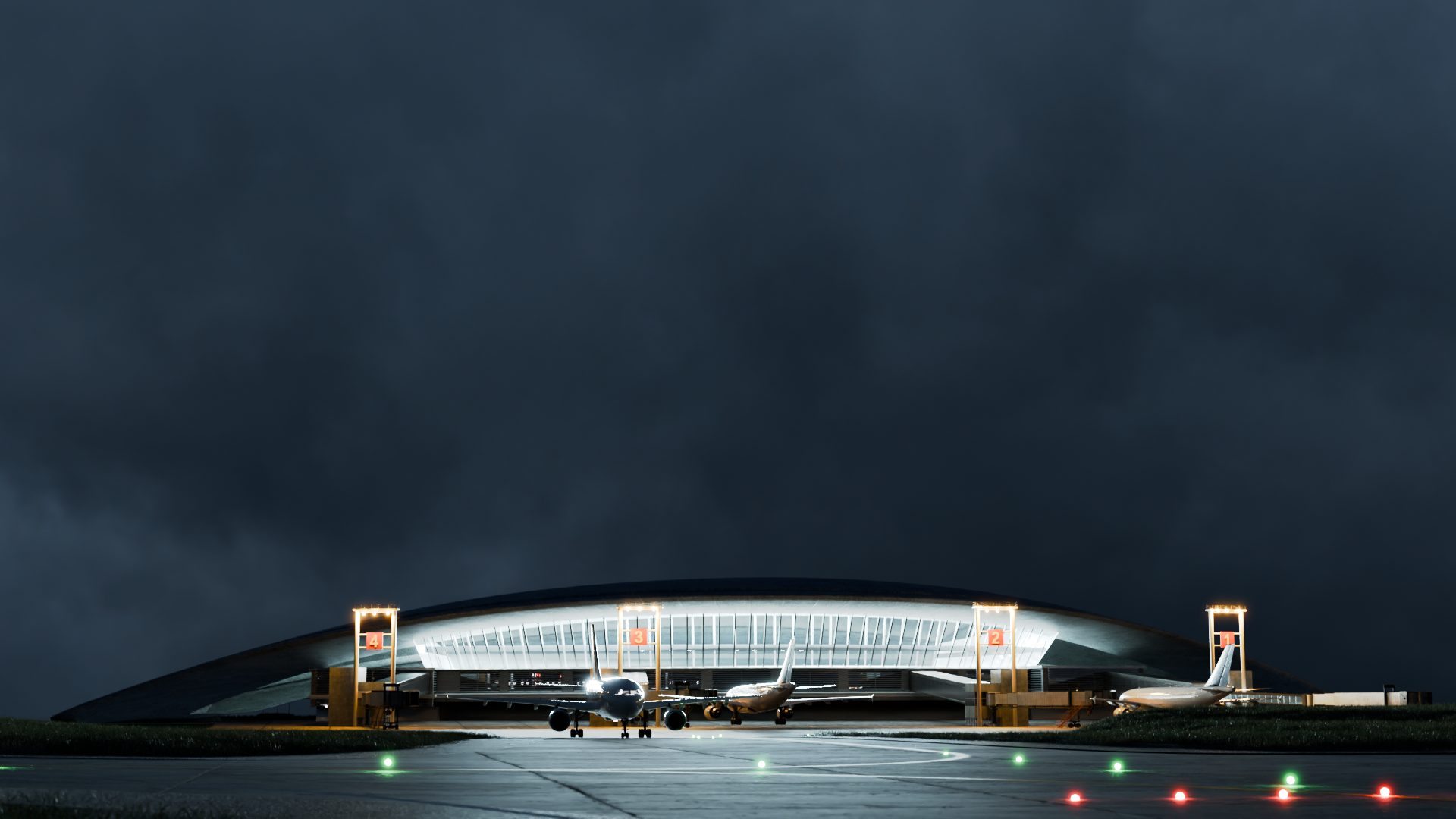
Visual Carrasco Categoría 3
Carrasco, Uruguay
EnginLabs desarrolló este detallado visual para explicar de que se trata esta importante mejora en el principal aeropuerto de nuestro país.
Aeropuertos del Uruguay anunció la instalación de un Sistema de Aterrizaje Instrumental de Precisión Categoría IIIb en el Aeropuerto Internacional de Carrasco. Esta avanzada tecnología permitirá que las aeronaves puedan aterrizar de manera segura incluso en condiciones climáticas adversas, fortaleciendo la infraestructura y posicionando a Uruguay como líder regional en conectividad aérea.
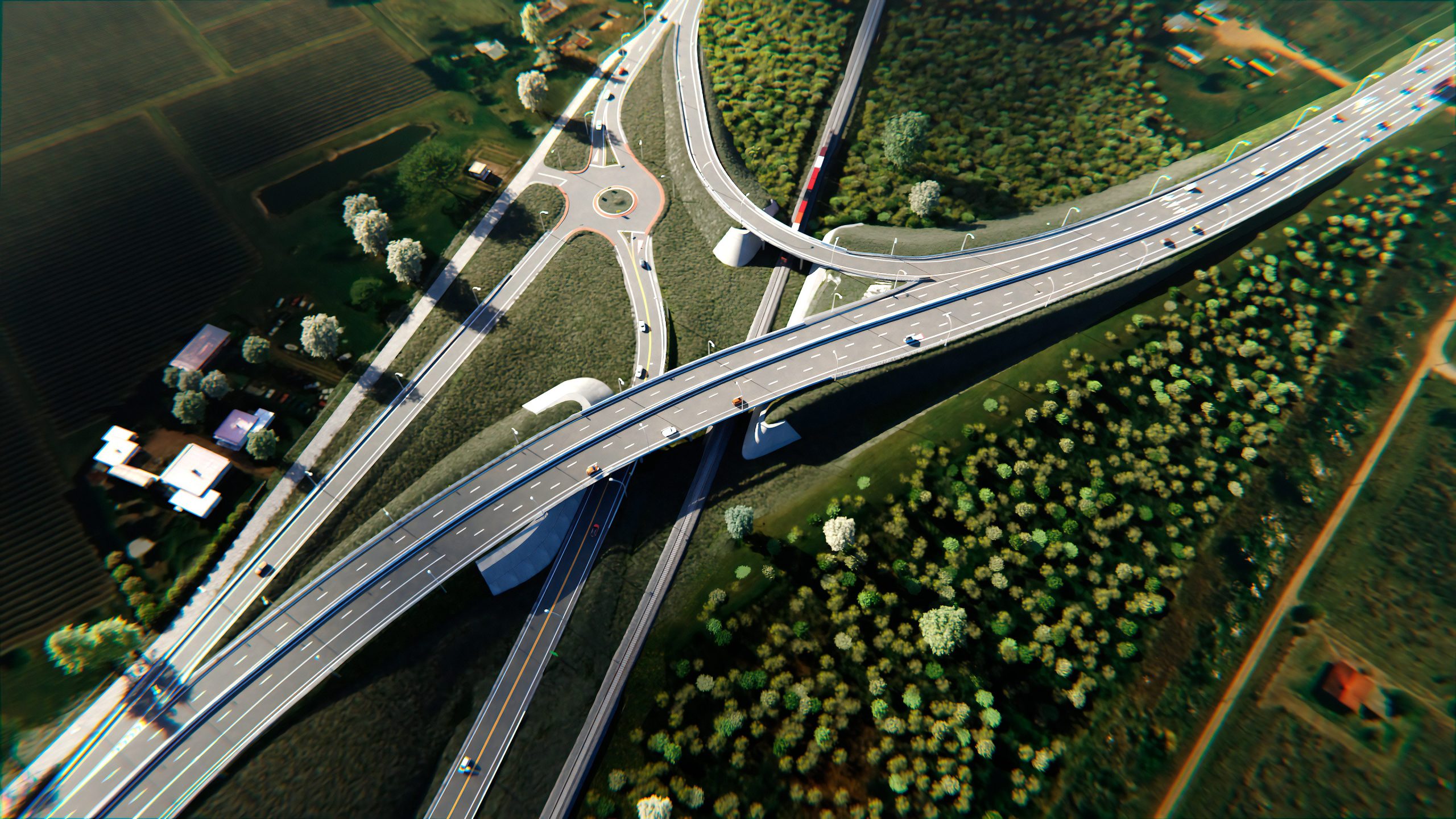
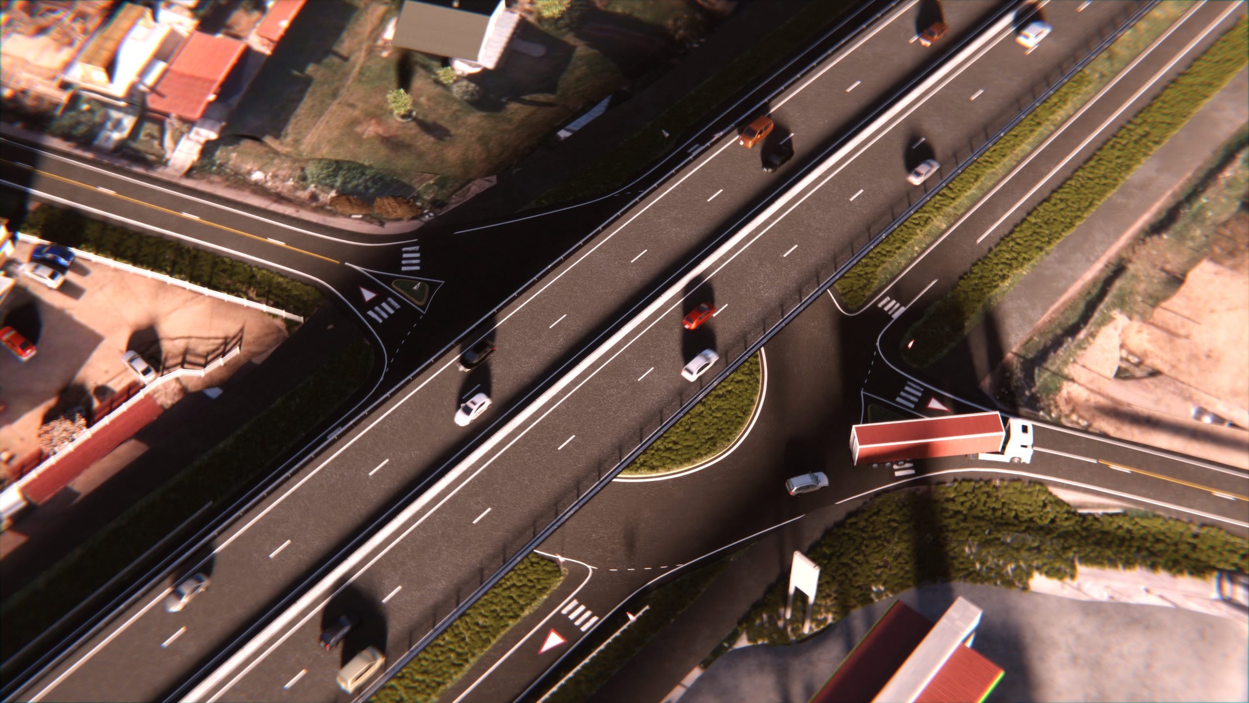
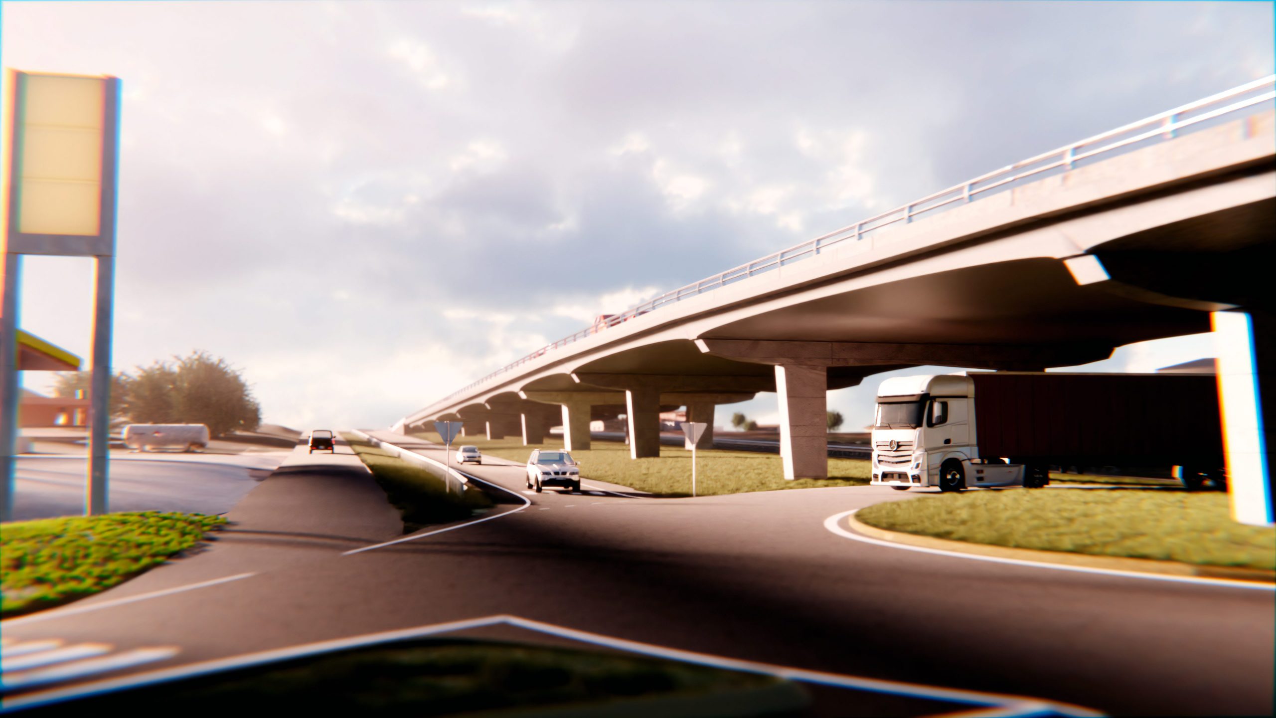
Interchange Route 5, South Access Canelones
Canelones, Uruguay
Visual made by EnginLabs for the construction of an interchange on Route 5, at the southern access to the city of Canelones.
The project will be built by the company Hernández y González S.A.
The project implies a great improvement in the mobility of the southern access to the city and solves the crossing with the Central Railway.
In addition to the model and visual, EnginLabs also prepared the executive project of signaling and road safety.
The video was used by the MTOP for the presentation of the work to the neighbors.
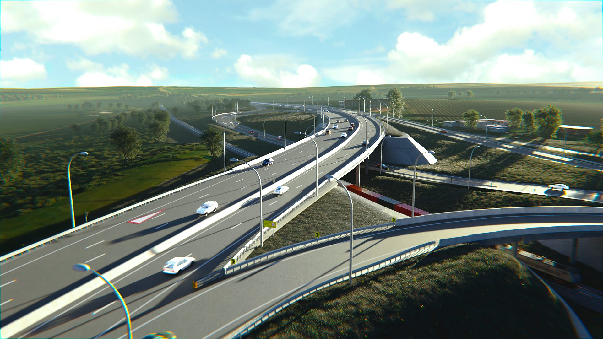
Animación Intercambiador
Florida, Uruguay
We share Visual of the Interchange project in the city of Florida, at the intersection of Ruta 5 with Camino a la Macana, carried out for the Consorcio Vial Ruta 5, formed by the companies STILER and INCOCI.
EnginLabs worked on the modelling and visualisation of this project, the work was carried out on the basis of the preliminary drafts of the companies RDA and CSI.
The video was used by the authorities for the presentation of the project to the neighbours. The photorealistic and detailed visuals of engineering works help to understand the design and the interaction with the environment, and assist in communicating an idea to the authorities and the general public.
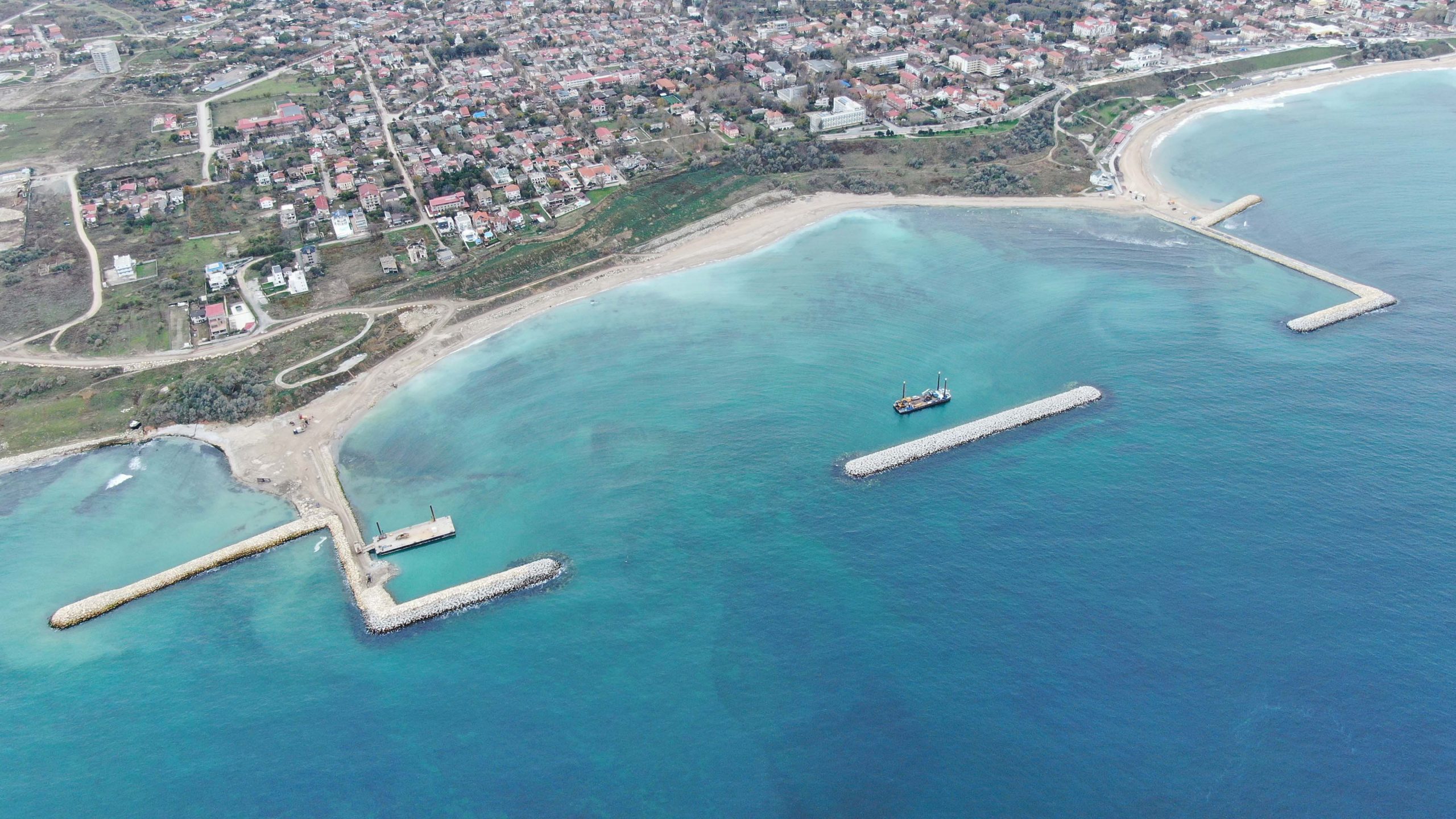
Constanta Beaches 3'rd Phase
Constanta, Romania
We are proud to announce that EnginLabs will assist Van Oord on the 6km Coastline renewal in Constanta, Romania.
New groynes and beaches will protect the popular coastal areas against the waves of the Black Sea – and at the same time boost the tourism sector. The projects consist not only of smart engineering; sustainability is also a major topic in the development. Several of the current breakwaters will be removed and redeveloped to make way for more nature-friendly alternative.
Source: Press Publication Van Oord
Minas - Parque Lineal
Minas, Uruguay
We work together with "Plan Proyecto Consultores" on a revitalisation project of a linear park in Minas.
In this context we conducted a survey with a drone of which we share a video of the point cloud. This work will be the basis of the studies to be carried out in the coming months.
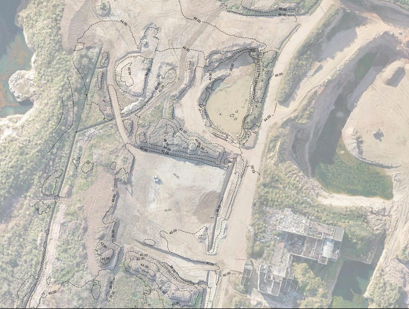
Drone Suvey Mine
La Paz, Uruguay
Content of the survey carried out for the Blue Quarry, located in the city of La Paz.
The video shows the point cloud made by photogrammetry with drone, from which a land surface model and a georeferenced orthomosaic were obtained, used for the construction site plans and volume calculation.
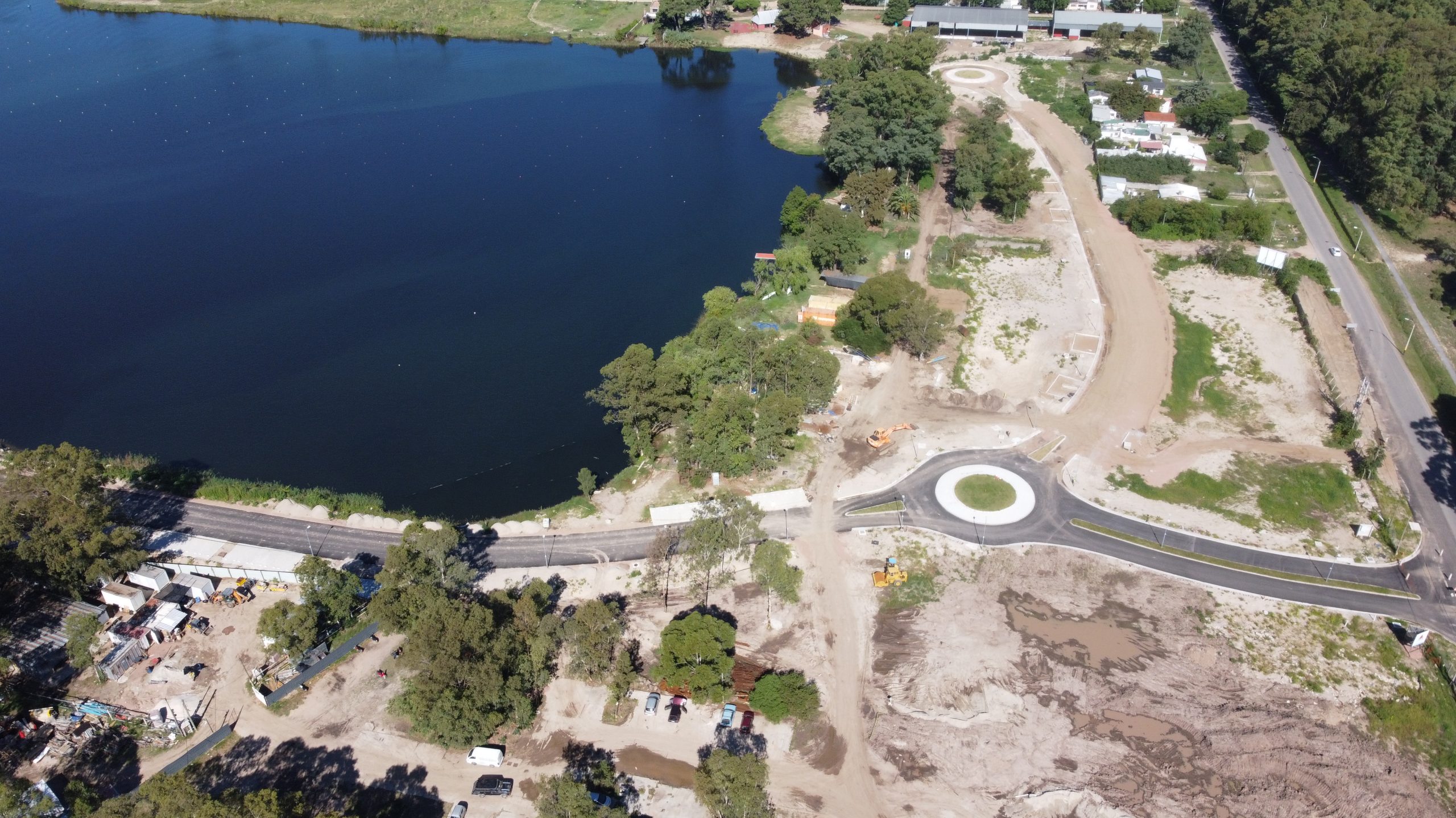
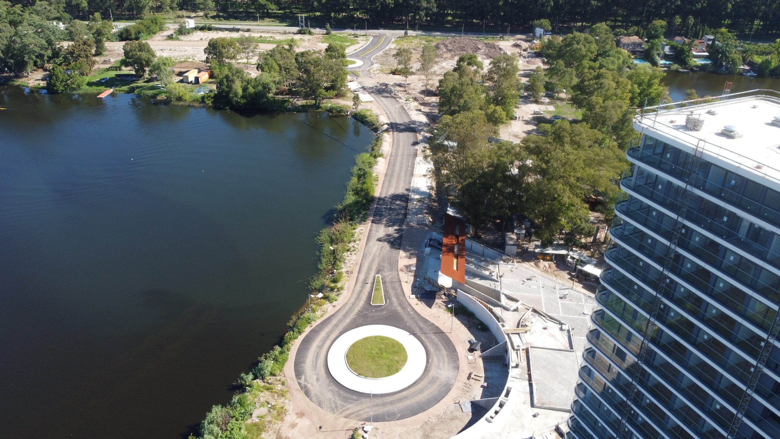
Carrasco Boating
Airport, Uruguay
Boating is located in a natural environment on one of the lakes of Carrasco. It perfectly combines nature with comfort and all the amenities of a large complex.
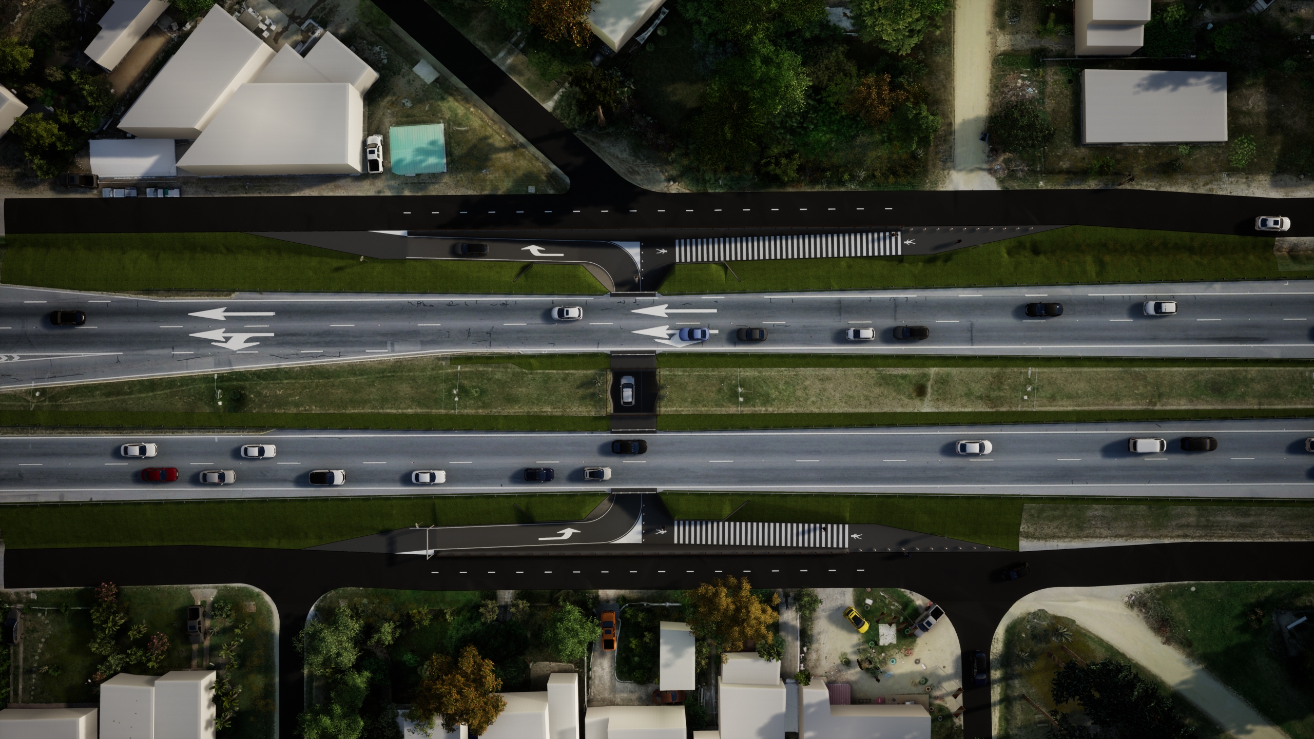
Underground Passages
Ruta Interbalnearia, Uruguay
We share an extract of the model made for the Underground Passages project on the Route Interbalnearia. EnginLabs worked in the early stages of the project, collaborating on the preliminary design and 3D modeling of the infrastructure, to present the initiative to government agencies.
The initiative was presented by the consortium of companies formed by Traxpalco, CVC, Molinsur and Colier, with the aim of improving the level of service of the Interbalnearia Route and speeding up the crossing of pedestrians and local light vehicles, through a low-cost and fast construction, which does not modify the roadway of the route.
Note: The images shown in the video are illustrative and were used to show the conceptual design, were made early in the project and may have differences from the final design.
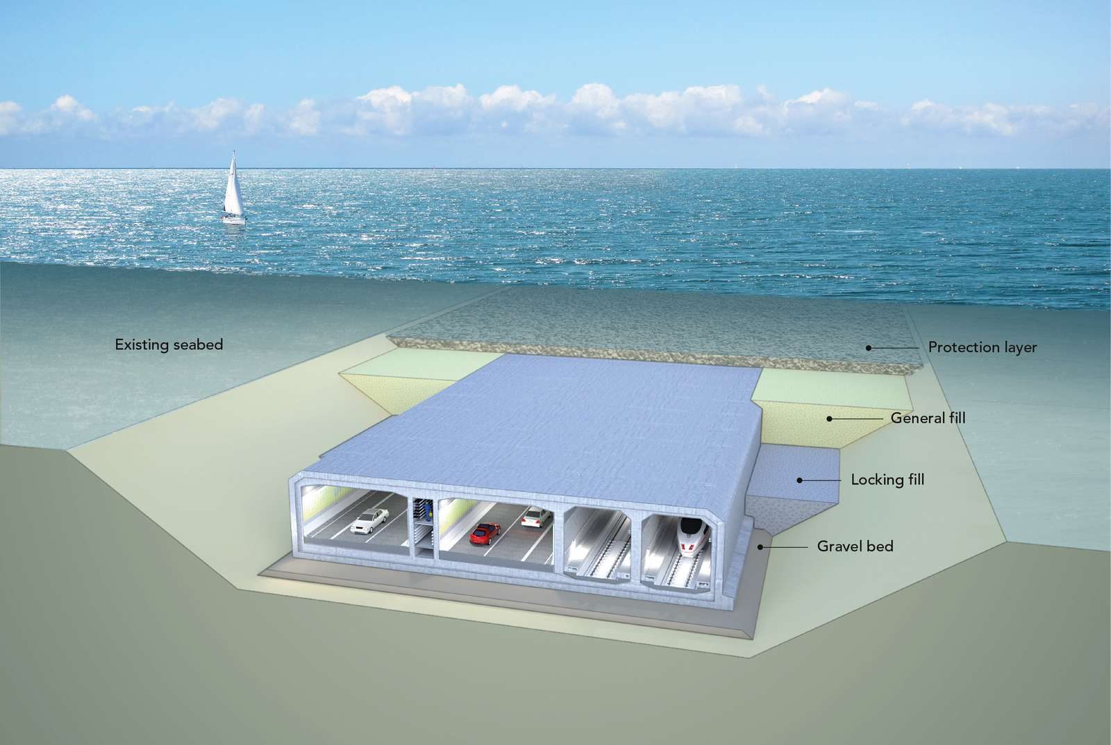
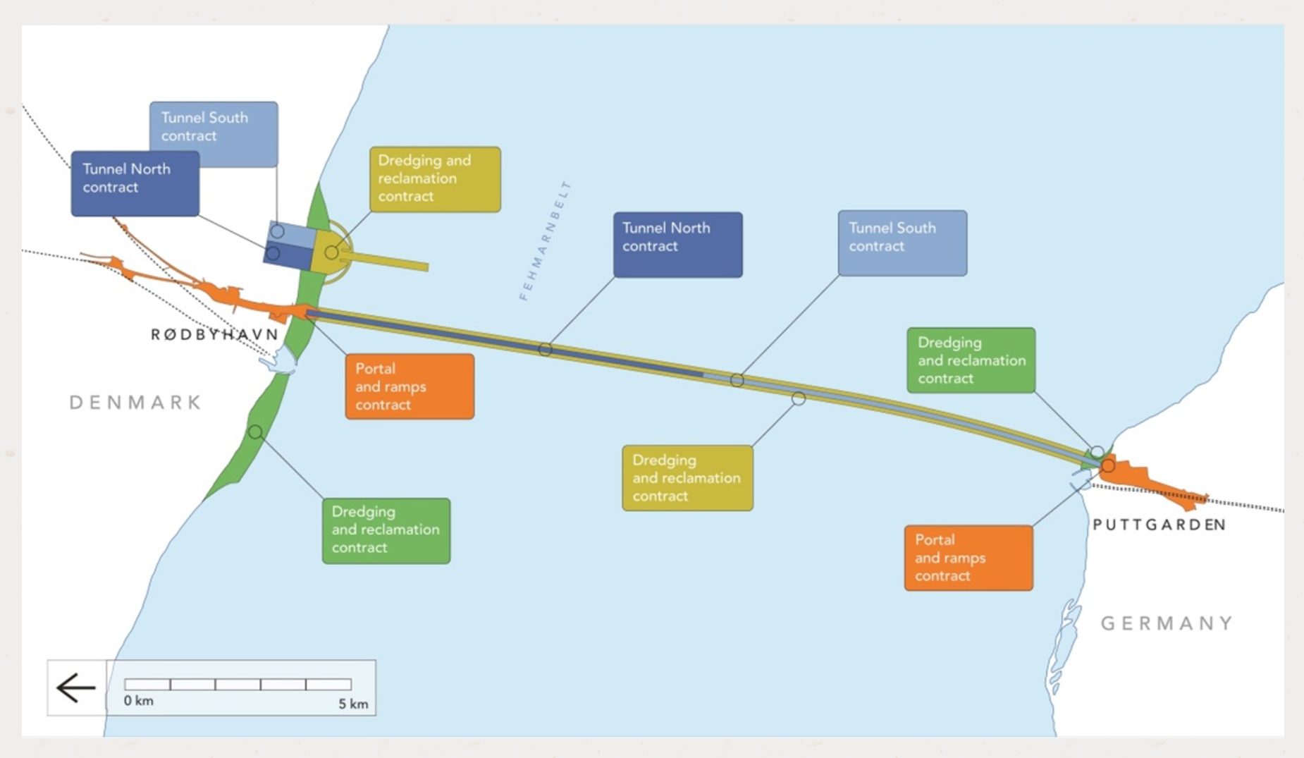
The Fehmarn Belt Fixed Link
Germany - Denmark
We are proud to share that, as a Uruguayan company based in Montevideo, EnginLabs is participating in an infrastructure work of magnitude and relevance in Europe, providing geometric design and BIM coordination services from Uruguay.
"The Fehmarn Belt Fixed Link" is the longest submerged tunnel ever built and will connect Germany with Denmark, it will be a key piece within the Scandinavian - Mediterranean corridor that connects the Scandinavian countries with the rest of Europe.
EnginLabs was contracted by the consortium of companies in charge of the dredging and filling tasks, consisting of Boskalis and Van Oord.
The design and modeling carried out by EnginLabs will have a constructive purpose and will be used for direct loading into the machinery guidance and control equipment.